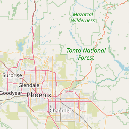
Latitude and longitude of St. Mary's High School (Phoenix, Arizona)
- Nearby Peoria, Arizona, United States
Satellite map of St. Mary's High School (Phoenix, Arizona)
St. Mary's Catholic High School is a private, Roman Catholic High School in Phoenix, Arizona.
Latitude: 33° 28' 18.59" N
Longitude: -112° 04' 4.80" W
Nearest city to this article: Phoenix
Read about St. Mary's High School (Phoenix, Arizona) in the Wikipedia Satellite map of St. Mary's High School (Phoenix, Arizona) in Google Maps


Leaflet | © OpenStreetMap contributors