Latitude and longitude of Des Moines metropolitan area
- Nearby Urbandale, United States
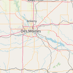
Satellite map of Des Moines metropolitan area
The Des Moines metropolitan area, officially known as the Des Moines-West Des Moines, IA Metropolitan Statistical Area (MSA), consists of five counties in central Iowa, United States: Polk, Dallas, Warren, Madison, and Guthrie. The 2010 census population of these counties was 569,633, and the 2013 estimated population was 599,789 .
Latitude: 41° 33' 18.53" N
Longitude: -93° 50' 8.99" W
Nearest city to this article: Waukee
Read about Des Moines metropolitan area in the Wikipedia Satellite map of Des Moines metropolitan area in Google Maps

Leaflet | © OpenStreetMap contributors