Latitude and longitude of Tattnall County, Georgia
- Nearby Claxton, Georgia, United States
Satellite map of Tattnall County, Georgia
Tattnall County is a county located in the southeast portion of the U.S. state of Georgia. As of the 2010 census, the population was 25,520. The county seat is Reidsville. The county was created on December 5, 1801 from part of Montgomery County, Georgia by the Georgia General Assembly.
Latitude: 32° 02' 24.00" N
Longitude: -82° 03' 36.00" W
Nearest city to this article: Reidsville, Georgia
Read about Tattnall County, Georgia in the Wikipedia Satellite map of Tattnall County, Georgia in Google Maps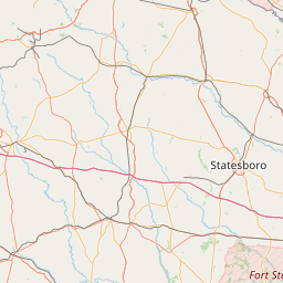


Leaflet | © OpenStreetMap contributors