Latitude and longitude of San Diego International Airport
- Nearby La Mesa, California, United States
Satellite map of San Diego International Airport
San Diego International Airport (IATA: SAN, ICAO: KSAN, FAA LID: SAN), also known as Lindbergh Field, is a public airport 3 mi (4.8 km) northwest of downtown San Diego, California.
Latitude: 32° 44' 0.59" N
Longitude: -117° 11' 13.80" W
Nearest city to this article: San Diego
Read about San Diego International Airport in the Wikipedia Satellite map of San Diego International Airport in Google Maps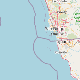


Leaflet | © OpenStreetMap contributors