Latitude and longitude of Auburn, Alabama
- Nearby Tuskegee, United States
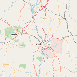
Satellite map of Auburn, Alabama
Auburn is a city in Lee County, Alabama, United States. It is the largest city in eastern Alabama with a 2013 population of 58,582. It is a principal city of the Auburn-Opelika Metropolitan Area.
Latitude: 32° 35' 31.19" N
Longitude: -85° 28' 30.59" W
Nearest city to this article: Auburn, Alabama
Read about Auburn, Alabama in the Wikipedia Satellite map of Auburn, Alabama in Google Maps


Leaflet | © OpenStreetMap contributors