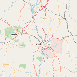
Latitude and longitude of Chewacla State Park
- Nearby Tuskegee, United States
Satellite map of Chewacla State Park
Chewacla State Park is a 696-acre (282 ha) state park in Auburn, Alabama.
Latitude: 32° 33' 14.72" N
Longitude: -85° 28' 51.06" W
Nearest city to this article: Auburn, Alabama
Read about Chewacla State Park in the Wikipedia Satellite map of Chewacla State Park in Google Maps


Leaflet | © OpenStreetMap contributors