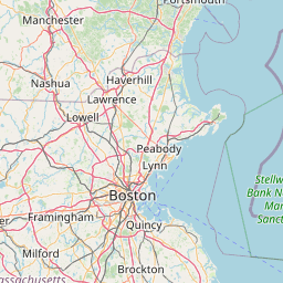
Latitude and longitude of Aureus University School of Medicine
- Nearby Hull, Massachusetts, United States
Satellite map of Aureus University School of Medicine
Aureus University School of Medicine (previously named All Saints University of Medicine) is a private university located in Oranjestad, Aruba, in the Caribbean.
Latitude: 42° 20' 11.40" N
Longitude: -71° 06' 12.96" W
Nearest city to this article: Brookline, Massachusetts
Read about Aureus University School of Medicine in the Wikipedia Satellite map of Aureus University School of Medicine in Google Maps


Leaflet | © OpenStreetMap contributors