Latitude and longitude of Jacksonville, Florida
- Nearby Jacksonville, Florida, United States
Satellite map of Jacksonville, Florida
Jacksonville is the largest city by population in the U.S. state of Florida, and the largest city by area in the contiguous United States. It is the county seat of Duval County, with which the city government consolidated in 1968. Consolidation gave Jacksonville its great size and placed most of its metropolitan population within the city limits; with an estimated population in 2013 of 842,583, it is the most populous city proper in Florida and the Southeast, and the 13th most populous in the United States.
Latitude: 30° 19' 9.86" N
Longitude: -81° 39' 36.00" W
Nearest city to this article: Jacksonville, Florida
Read about Jacksonville, Florida in the Wikipedia Satellite map of Jacksonville, Florida in Google Maps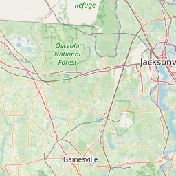


Leaflet | © OpenStreetMap contributors