Latitude and longitude of Florida Gulf Coast University
- Nearby North Fort Myers, United States
Satellite map of Florida Gulf Coast University
Florida Gulf Coast University (FGCU) is a public university located just south of the Southwest Florida International Airport in unincorporated Lee County, Florida. The university belongs to the 12-campus State University System of Florida.
Latitude: 26° 27' 45.00" N
Longitude: -81° 46' 22.43" W
Nearest city to this article: San Carlos Park
Read about Florida Gulf Coast University in the Wikipedia Satellite map of Florida Gulf Coast University in Google Maps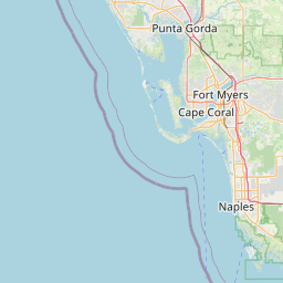


Leaflet | © OpenStreetMap contributors