Latitude and longitude of Bartlesville High School
- Nearby Dewey, Oklahoma, United States
Satellite map of Bartlesville High School
Bartlesville High School is a public high school located in Bartlesville, Oklahoma. Built in 1939, it was originally called College High School, and until 1950 housed a junior college as well as the high school.
Latitude: 36° 44' 1.62" N
Longitude: -95° 58' 26.99" W
Nearest city to this article: Bartlesville
Read about Bartlesville High School in the Wikipedia Satellite map of Bartlesville High School in Google Maps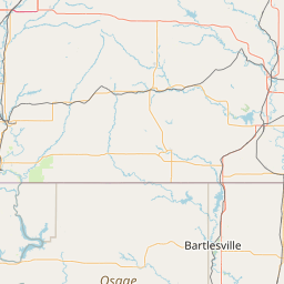


Leaflet | © OpenStreetMap contributors