Latitude and longitude of Logan Heights, San Diego
Satellite map of Logan Heights, San Diego
Logan Heights is a neighborhood in central San Diego, California.
Latitude: 32° 42' 0.00" N
Longitude: -117° 05' 60.00" W
Nearest city to this article: National City, California
Read about Logan Heights, San Diego in the Wikipedia Satellite map of Logan Heights, San Diego in Google Maps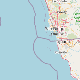


Leaflet | © OpenStreetMap contributors