Latitude and longitude of Mission Trails Regional Park
- Nearby Lakeside, California, United States
Satellite map of Mission Trails Regional Park
Mission Trails Regional Park is a 5,800-acre (23 km2) open space preserve within the city of San Diego, California, established in 1974. It is the sixth-largest municipally owned park in the United States, and the largest in California.
Latitude: 32° 49' 40.14" N
Longitude: -117° 03' 3.91" W
Nearest city to this article: Santee, California
Read about Mission Trails Regional Park in the Wikipedia Satellite map of Mission Trails Regional Park in Google Maps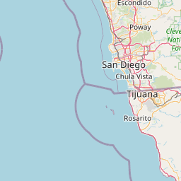


Leaflet | © OpenStreetMap contributors