Latitude and longitude of Lawrence County, Alabama
- Nearby Moulton, Alabama, United States
Satellite map of Lawrence County, Alabama
Lawrence County is a county of the U.S. state of Alabama. As of the 2010 census, the population was 34,339, with the most Native American residents of any county in the state. The county seat is Moulton.
Latitude: 34° 31' 10.19" N
Longitude: -87° 18' 22.20" W
Nearest city to this article: Moulton, Alabama
Read about Lawrence County, Alabama in the Wikipedia Satellite map of Lawrence County, Alabama in Google Maps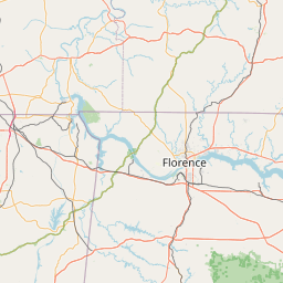


Leaflet | © OpenStreetMap contributors