Latitude and longitude of Table Rock, Niagara Falls
- Nearby Amherst, New York, United States
Satellite map of Table Rock, Niagara Falls
Table Rock was a large shelf of rock that jutted out from the Canadian shore of Niagara Falls, Ontario, just north of the present day observation and commercial complex. Revealed in the mid-18th century as the Horseshoe Falls receded, Table Rock was the first major vantage point for tourists of the early and mid-19th century.
Latitude: 43° 04' 44.95" N
Longitude: -79° 04' 42.39" W
Nearest city to this article: Niagara Falls
Read about Table Rock, Niagara Falls in the Wikipedia Satellite map of Table Rock, Niagara Falls in Google Maps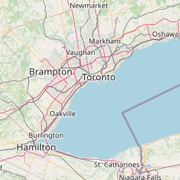


Leaflet | © OpenStreetMap contributors