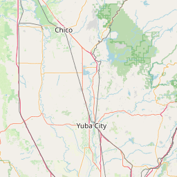
Latitude and longitude of Chico Municipal Airport
- Nearby Paradise, California, United States
Satellite map of Chico Municipal Airport
Chico Municipal Airport (IATA: CIC, ICAO: KCIC, FAA LID: CIC), often called CMA, is four miles (6 km) north of Chico, in Butte County, California. The airport covers 1,475 acres (6 km²), has two runways and one helipad. The airport's fixed base operator, "Northgate Aviation". , provides fuel, maintenance, flight training and charter flights.
Latitude: 39° 47' 25.79" N
Longitude: -121° 51' 17.99" W
Nearest city to this article: Chico, California
Read about Chico Municipal Airport in the Wikipedia Satellite map of Chico Municipal Airport in Google Maps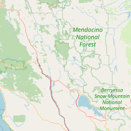


Leaflet | © OpenStreetMap contributors