Latitude and longitude of San Carlos Apache Airport
Satellite map of San Carlos Apache Airport
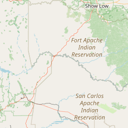
San Carlos Apache Airport (IATA: GLB, FAA LID: P13) is a public use airport located seven nautical miles (8 mi, 13 km) southeast of the central business district of Globe, a city in Gila County, Arizona, United States. The airport is owned by the San Carlos Apache Tribe.
Latitude: 33° 21' 6.59" N
Longitude: -110° 40' 1.79" W
Nearest city to this article: Globe, Arizona
Read about San Carlos Apache Airport in the Wikipedia Satellite map of San Carlos Apache Airport in Google Maps


Leaflet | © OpenStreetMap contributors