Latitude and longitude of Rockingham County, New Hampshire
- Nearby Seabrook, New Hampshire, United States
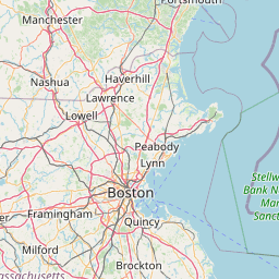
Satellite map of Rockingham County, New Hampshire
Rockingham County is a county located in the U.S. state of New Hampshire. As of the 2010 census, the population was 295,223, making it the second-most populous county in New Hampshire.
Latitude: 42° 50' 17.99" N
Longitude: -71° 07' 1.80" W
Nearest city to this article: Plaistow, New Hampshire
Read about Rockingham County, New Hampshire in the Wikipedia Satellite map of Rockingham County, New Hampshire in Google Maps


Leaflet | © OpenStreetMap contributors