Latitude and longitude of Mexico, Indiana
- Nearby Grissom Air Force Base, United States
Satellite map of Mexico, Indiana
Mexico is a census-designated place (CDP) in Miami County, Indiana, United States.
Latitude: 40° 49' 7.19" N
Longitude: -86° 06' 30.00" W
Nearest city to this article: Peru, Indiana
Read about Mexico, Indiana in the Wikipedia Satellite map of Mexico, Indiana in Google Maps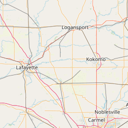


Leaflet | © OpenStreetMap contributors