Latitude and longitude of Zuber, Florida
- Nearby Ocala, United States
Satellite map of Zuber, Florida
Zuber is an unincorporated community in Marion County, Florida, United States. It is located near the intersection of State Road 326 and County Road 25A.
Latitude: 29° 16' 0.60" N
Longitude: -82° 10' 31.20" W
Nearest city to this article: Ocala
Read about Zuber, Florida in the Wikipedia Satellite map of Zuber, Florida in Google Maps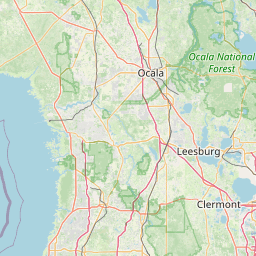


Leaflet | © OpenStreetMap contributors