Latitude and longitude of Munroe Regional Medical Center
- Nearby Ocala, United States
Satellite map of Munroe Regional Medical Center
Munroe Regional Medical Center is an acute care community hospital in Ocala, Florida.
Latitude: 29° 10' 30.36" N
Longitude: -82° 08' 18.18" W
Nearest city to this article: Ocala
Read about Munroe Regional Medical Center in the Wikipedia Satellite map of Munroe Regional Medical Center in Google Maps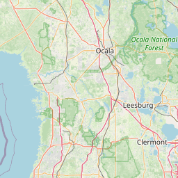


Leaflet | © OpenStreetMap contributors