Latitude and longitude of Fresno Chandler Executive Airport
- Nearby San Joaquin, California, United States
Satellite map of Fresno Chandler Executive Airport
Fresno Chandler Executive Airport (IATA: FCH, ICAO: KFCH, FAA LID: FCH) is a public use airport two miles (3 km) west of the central business district of Fresno, in Fresno County, California, United States.
Latitude: 36° 43' 33.59" N
Longitude: -119° 49' 7.79" W
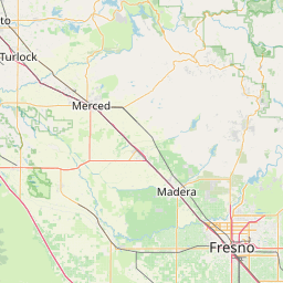

Leaflet | © OpenStreetMap contributors