Latitude and longitude of Rancho Santa Fe, California
- Nearby Fairbanks Ranch, United States
Satellite map of Rancho Santa Fe, California
Rancho Santa Fe (Spanish: santa—holy, fe—faith) known locally as ″The Ranch″, is a census-designated place (CDP) in San Diego County, California, United States, within the San Diego metropolitan area. With an estimated (2010) median income of $188,859, it is on the list of highest income communities in the United States with a population of at least 1,000. The population was 3,117 at the 2010 census, down from 3,252 at the 2000 census.
Latitude: 33° 01' 15.60" N
Longitude: -117° 11' 60.00" W
Nearest city to this article: Rancho Santa Fe
Read about Rancho Santa Fe, California in the Wikipedia Satellite map of Rancho Santa Fe, California in Google Maps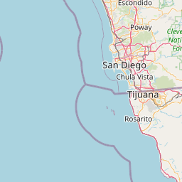


Leaflet | © OpenStreetMap contributors