Latitude and longitude of Five Mile River (East Brookfield River)
Satellite map of Five Mile River (East Brookfield River)
The Five Mile River (Fivemile River on federal maps) is a 10.1-mile-long (16.3 km) river in central Massachusetts, part of the Chicopee River watershed.
Latitude: 42° 17' 24.60" N
Longitude: -72° 02' 10.20" W

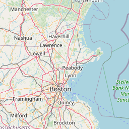


Leaflet | © OpenStreetMap contributors