Latitude and longitude of Centralia College
- Nearby Grand Mound, Washington, United States
Satellite map of Centralia College
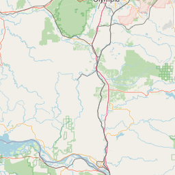
Centralia College, an institution of higher learning located in Centralia, Washington, is a two-year institution and in 2012 began offering a Bachelor of Applied Science in Applied Management degree (BAS-AM) and now offers a Bachelor of Applied Science in Diesel Technology (BAS-D). Founded in 1925, Centralia is the oldest continuously operating community college in the state of Washington. As shown below, the college sits on 29 acres (120,000 m2) in the middle of the town of Centralia. There is a branch education center, Centralia College East, in the town of Morton and the college offers a range of online and correspondence courses.
Latitude: 46° 42' 57.42" N
Longitude: -122° 57' 33.98" W
Nearest city to this article: Centralia, Washington
Read about Centralia College in the Wikipedia Satellite map of Centralia College in Google Maps