Latitude and longitude of University of Western States
- Nearby Beaverton, Oregon, United States
Satellite map of University of Western States
University of Western States (formerly known as Western States Chiropractic College) is a chiropractic college in Northeast Portland, Oregon.
Latitude: 45° 32' 34.80" N
Longitude: -122° 31' 22.80" W
Nearest city to this article: Oak Hills, Oregon
Read about University of Western States in the Wikipedia Satellite map of University of Western States in Google Maps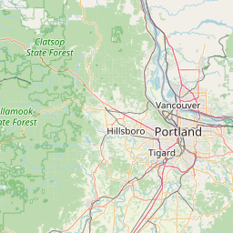


Leaflet | © OpenStreetMap contributors