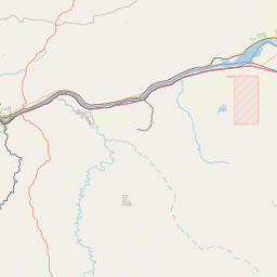
Latitude and longitude of 1985 Rajneeshee assassination plot
- Nearby Beaverton, Oregon, United States
Satellite map of 1985 Rajneeshee assassination plot
The 1985 Rajneeshee assassination plot was a conspiracy by a group of high-ranking followers of Bhagwan Shree Rajneesh (now known as Osho) to assassinate Charles Turner, the then-United States Attorney for the District of Oregon. Rajneesh's personal secretary and second-in-command, Ma Anand Sheela (Sheela Silverman), assembled the group after Turner was appointed to investigate illegal activity at Rajneeshpuram.
Latitude: 45° 30' 34.19" N
Longitude: -122° 40' 20.99" W
Nearest city to this article: Cedar Hills, Oregon
Read about 1985 Rajneeshee assassination plot in the Wikipedia Satellite map of 1985 Rajneeshee assassination plot in Google Maps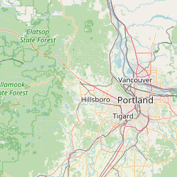


Leaflet | © OpenStreetMap contributors