Latitude and longitude of Frank H. Peterson Academies of Technology
- Nearby Lakeside, Florida, United States
Satellite map of Frank H. Peterson Academies of Technology
Frank H. Peterson Academies of Technology is a public, magnet high school located in Jacksonville, Florida.
Latitude: 30° 15' 52.27" N
Longitude: -81° 46' 7.71" W
Nearest city to this article: Jacksonville, Florida
Read about Frank H. Peterson Academies of Technology in the Wikipedia Satellite map of Frank H. Peterson Academies of Technology in Google Maps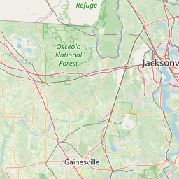


Leaflet | © OpenStreetMap contributors