Latitude and longitude of List of crossings of the Merrimack River
- Nearby West Newbury, United States
Satellite map of List of crossings of the Merrimack River
This is a list of bridges and other crossings of the Merrimack River from its mouth at the Gulf of Maine upstream to its source at the merger of two rivers.
Latitude: 42° 48' 34.72" N
Longitude: -70° 52' 14.56" W
Nearest city to this article: Newburyport
Read about List of crossings of the Merrimack River in the Wikipedia Satellite map of List of crossings of the Merrimack River in Google Maps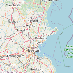


Leaflet | © OpenStreetMap contributors