Latitude and longitude of Taylor River (New Hampshire)
Satellite map of Taylor River (New Hampshire)
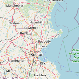
The Taylor River is a 10.6 mile long (17.1 km) river located in southeastern New Hampshire in the United States. It is a tributary of the Hampton River, a tidal inlet of the Atlantic Ocean.
Latitude: 42° 55' 19.20" N
Longitude: -70° 50' 9.60" W


Leaflet | © OpenStreetMap contributors