Latitude and longitude of Navajo Lake Airport
- Nearby Bloomfield, New Mexico, United States
Satellite map of Navajo Lake Airport
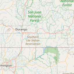
Navajo Lake Airport (FAA LID: 1V0) is a public use airport owned by the New Mexico State Highway and Transportation Department and located in San Juan County, New Mexico, United States. The airport is situated west of Navajo Lake.
Latitude: 36° 48' 17.99" N
Longitude: -107° 39' 2.99" W
Nearest city to this article: Aztec, New Mexico
Read about Navajo Lake Airport in the Wikipedia Satellite map of Navajo Lake Airport in Google Maps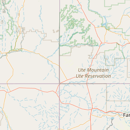

Leaflet | © OpenStreetMap contributors