Lovdal, California
Lovdal is an unincorporated community in Yolo County, California. It lies at an elevation of 20 feet (6 m). The area is named after the Lovdal family that owned 2,800 acres (11 km2) of land in the area by 1903.
Rosemont is a census-designated place (CDP) in Sacramento County, California, United States. It is part of the Sacramento–Arden-Arcade–Roseville Metropolitan Statistical Area.
Population: 22,681
Latitude: 38° 33' 6.66" N
Longitude: -121° 21' 52.81" W


Lovdal is an unincorporated community in Yolo County, California. It lies at an elevation of 20 feet (6 m). The area is named after the Lovdal family that owned 2,800 acres (11 km2) of land in the area by 1903.
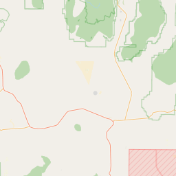
Leeman is a former settlement in Yolo County, California. It lay at an elevation of 23 feet (7 m). It still appeared on maps as of 1916.
Kobe is a former settlement in Yolo County, California. It was located on the Southern Pacific Railroad 3.25 miles (5.2 km) west of West Sacramento, at an elevation of 33 feet (10 m). It still appeared on maps as of 1916.
Kiesel is an unincorporated community in Yolo County, California. It is located on the Sacramento Northern Railroad 10.5 miles (17 km) northeast of Davis, at an elevation of 26 feet (8 m).
Hazel is a side platformed Sacramento RT light rail station in Gold River, California, United States. The station was opened on October 15, 2005, and is operated by the Sacramento Regional Transit District. As part of the Gold Line, it has service t…
Gardenland is a neighborhood in the city of Sacramento, California around the Natomas Basin. It borders Northgate Boulevard to the west, Indiana Avenue to the north, the East Levee Basin to the east, and the Arden-Garden Highway to the south.
Fruitridge is an island platformed Sacramento RT light rail station in Sacramento, California, United States. The station was opened on September 26, 2003, and is operated by the Sacramento Regional Transit District.
Florin is a side platformed Sacramento RT light rail station in Sacramento, California, United States. The station was opened on September 26, 2003, and is operated by the Sacramento Regional Transit District. As part of the Blue Line, it has servic…
Esquire Tower, also known as Esquire Plaza, is a 322 foot (98 m) 248,816 square foot office building in downtown Sacramento, California.
Dry Creek (formerly called Linda Creek) is a 15-mile (24 km) long stream in Placer County and Sacramento County, California, USA, tributary to the Sacramento River. Its watershed lies within the Sacramento Valley.
Central is an unincorporated community in Yolo County, California. It is located on the Sacramento Northern Railroad 3 miles (4.8 km) southwest of Clarksburg, at an elevation of 3 feet (1 m).
Bryte (formerly, Riverbank) is a former town in Yolo County, California, now forming part of West Sacramento. It is located just south of the Sacramento River in the eastern portion of the county. Bryte's ZIP Code is 95605 and its area code 916. It …
Beatrice is an unincorporated community in Yolo County, California. It is located on the Sacramento Northern Railroad 10.5 miles (17 km) northeast of Davis, at an elevation of 26 feet (8 m).
Arthur A. Benjamin Health Professions High School (AABHPHS) is a small high school in the Upper Land Park neighborhood of Sacramento, California.
59th Street is a side platformed Sacramento RT light rail station in the Fairgrounds neighborhood of Sacramento, California, United States. The station was opened on September 5, 1987, and is operated by the Sacramento Regional Transit District. As …
Zinfandel is a side platformed Sacramento RT light rail station in Rancho Cordova, California, United States. The station was opened on June 11, 2004, and is operated by the Sacramento Regional Transit District. As part of the Gold Line, it has serv…
Willow Point is an unincorporated community in Yolo County, California. It is located on the Sacramento Northern Railroad 1.5 miles (2.4 km) west-northwest of Clarksburg, at an elevation of 0 feet (0 m).
Vin is an unincorporated community in Yolo County, California. It is located on the Sacramento and Woodland Railroad 7 miles (11 km) northwest of West Sacramento, at an elevation of 30 feet (9 m).