Alabama Hill, California
Alabama Hill is an unincorporated community in Calaveras County, California. It lies at an elevation of 2972 feet (906 m). Miners from Alabama settled here in 1849 and named the place after their native state.
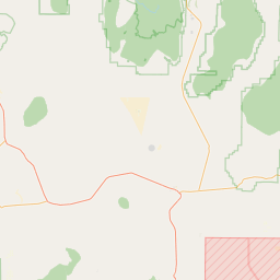
San Andreas is an unincorporated census-designated place and the county seat of Calaveras County, California. The population was 2,783 at the 2010 census, up from 2,615 at the 2000 census. Like most towns in the region, it was originally founded during the California Gold Rush.
Population: 2,783
Latitude: 38° 11' 45.71" N
Longitude: -120° 40' 49.76" W


Alabama Hill is an unincorporated community in Calaveras County, California. It lies at an elevation of 2972 feet (906 m). Miners from Alabama settled here in 1849 and named the place after their native state.
Sutter Hill is an unincorporated community in Amador County, California. It is located 7.25 miles (11.7 km) south-southeast of Plymouth, at an elevation of 1562 feet (476 m).
Sunnybrook (formerly, Vogans) is an unincorporated community in Amador County, California. It is located on Mountain Spring Creek 3 miles (4.8 km) east of Ione. It lies at an elevation of 784 feet (239 m).
South Camanche Shore is an unincorporated community in Calaveras County, California. It lies at an elevation of 443 feet (135 m).
Scenic Valley Ranchos is an unincorporated community in Calaveras County, California. It lies at an elevation of 384 feet (117 m).
It was established in 1849 as a trading center for miners of the area. The settlement, in an area that was home to many Miwok Indians, was named after the gulch where William and Dan Carsner found large nuggets of gold embedded in the coarse sands. …
Ranch House Estates is an unincorporated community in Amador County, California. It lies at an elevation of 2546 feet (776 m).
Quail Oaks is an unincorporated community in Calaveras County, California. It lies at an elevation of 656 feet (200 m).
Pine Acres is an unincorporated community in Amador County, California. It lies at an elevation of 2684 feet (818 m).
Oak Grove is an unincorporated community in Calaveras County, California. It lies at an elevation of 292 feet (89 m).
Norval is a former settlement in Calaveras County, California, along the Southern Pacific Railroad. It lay at an elevation of 689 feet (210 m). It still appeared on maps as of 1944.
This list includes properties and districts listed on the National Register of Historic Places in Calaveras County, California.
Mountain Ranch Subdivision is an unincorporated community in Calaveras County, California, adjacent to Mountain Ranch. It lies at an elevation of 1142 feet (348 m).
Mother Lode Acres is an unincorporated community in Calaveras County, California. It lies at an elevation of 243 feet (74 m).
Milligan District (also, Slabtown and Hoodsville) is a former settlement in Amador County, California. It lay at an elevation of 1601 feet (488 m).
Lake Amador is a reservoir located in Amador County, California.
La Honda Park is an unincorporated community in Calaveras County, California. It lies at an elevation of 1791 feet (546 m).
Independence is an unincorporated community in Calaveras County, California. It lies at an elevation of 2631 feet (802 m).